
In the twenty-first century, New York is more than simply a busy metropolis famed for its culture and attractions. New York is a genuine innovation center. For many years, the city’s residents have been actively adopting sustainable development methods, combating climate change and taking care of the environment, especially water resources. Hydrological stations in New York are critical to understanding and managing the region’s water resources. They are vital centers for collecting data, monitoring water levels and analyzing the general state of New York City’s water resources. Find out more at new-york.name.
Hydrological research in New York
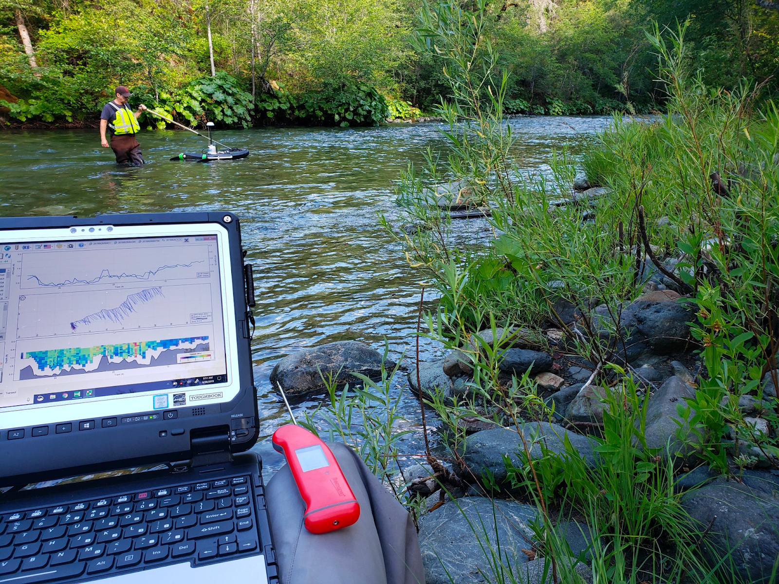
Hydrological research is a broad area that studies the quantity, quality and movement of water in natural and artificial systems. This study is especially significant in the case of New York because of the city’s complex hydrological infrastructure, which includes rivers, reservoirs and an enormous network of underground tunnels and pipelines. Understanding how these systems operate is critical for effective water management, flood prevention and the provision of a sustainable water supply for millions of those living in the city.
At the beginning of the 21st century, a system for monitoring ground and surface water was introduced in New York City. This solution was essential to collect a considerable amount of hydrological data for future use in water research.
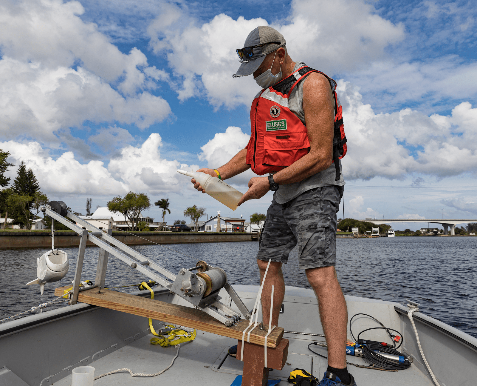
In particular, in New York, hydrological research is carried out by the United States Geological Survey and the New York City Department of Environmental Protection. They collect continuous data from urban hydrological stations to assess, plan and protect water resources. In particular, on the territory of New York City and its surrounding areas, there are:
- 225 observation wells
- 8 river stations
- 10 lake and pond monitoring stations.
Ground and surface water levels in New York City are monitored at various periods to provide an accurate approximation of seasonal fluctuations and patterns. Data on water quality in New York City is gathered to monitor the levels of nutrients and contaminants. This is necessary in order to assess the quality of water in aquifer systems and the possibility of using it as a secondary source of water supply for city residents. The U.S. Geological Survey conducts a thorough analysis of each sample taken from the hydrological stations in New York City. They test the water for a variety of components, including:
- individual nutrients
- basic ions
- microelements
- volatile and semi-volatile organic compounds
- pesticides.
Challenges of hydrological research in New York
The growing demand for reliable and up-to-date data is one of the most significant difficulties confronting hydrological stations in New York. As cities continue to develop fast in the 21st century, the requirement for integrated water management grows. To make informed decisions, the US Geological Survey and the New York City Department of Environmental Protection require precise information regarding river discharge, groundwater levels, precipitation patterns and water quality. However, gathering this information may be a difficult process that involves continual monitoring and the installation of fairly complex equipment. Furthermore, the massive volume of data created by hydrological stations poses a lot of challenges in terms of storage, processing and interpretation.
Urbanization and climate change
Another significant problem of New York hydrological research is the influence of urbanization on water supplies. As New York City grew, green places were frequently replaced with impermeable surfaces such as concrete and asphalt. As a result, these surfaces interfered with the natural water cycle. Concrete and asphalt impair rainwater from entering the earth, resulting in greater runoff and less replenishment of groundwater supplies. This phenomenon, known as the urban heat island effect, exacerbates floods after heavy rains and leads to water scarcity during dry seasons.
In the 21st century, the challenges brought on by urbanization are resolved by setting up hydrological stations in New York City and keeping track of the condition of water supplies. The stations may be utilized to develop effective strategies for sustainable water management.
Furthermore, climate change brings new challenges for hydrological studies in New York. Rising global temperatures have increased the frequency of extreme weather occurrences such as severe storms and prolonged droughts. These changes have a substantial impact on the hydrological cycle, causing changes in precipitation patterns and water availability. As a result, hydrological stations in the 21st century must continually adjust their monitoring and data-gathering methods to account for changing climatic conditions, maintaining consistency in water management methods.
To tackle these issues, collaboration between hydrological stations, research institutes and government organizations is vital. For improving hydrological data accuracy and timelines, it is as much important to invest in advanced monitoring technology, including remote sensing and real-time data gathering systems.
More than ever, in the 21st century, New York City’s hydrological stations are critical to monitoring and comprehending the city’s water supplies.